
Short Answer
Franz Josef Land (Russian: Земля Франца‑Иосифа) is a remote archipelago in the Barents Sea, lying between 80° N and 81° N latitude. Its position north of the Arctic Circle, combined with its maritime setting, creates a harsh polar climate that influences every aspect of the islands’ glaciation, wildlife and human activity. Understanding the weather patterns here is essential for navigation, scientific research, and the management of the Russian Arctic National Park, which now protects the entire group.
Annual temperature averages are well below freezing, with a mean of –2 °C for the whole archipelago. The short summer window, centred on July, brings the highest mean temperature of 9 °C, while the dead‑of‑winter month of January averages –12 °C. Precipitation is low by global standards – roughly 335 mm per year – but most of it falls as snow, contributing to the permanent ice cover that blankets about 80 % of the islands. Wind is a dominant factor year‑round; mean speeds exceed 49 km/h and gusts regularly surpass 70 km/h, shaping sea‑ice dynamics and surface weather.
Study Area
The climate description below refers to the climatological record compiled for the Malye Karmakuly weather station, the nearest long‑term site to the archipelago (approximately 965 km south). Although local micro‑climates vary – especially on ice‑free coastal pockets – the station data provide a reliable baseline for the entire group.
What Scientists Measure
Modern climatological monitoring in Franz Josef Land relies on a combination of automatic weather stations (AWS), satellite remote sensing, and occasional field campaigns from research vessels or ice‑breaker platforms. Core parameters include:
- Air temperature – measured at 2 m height, recorded hourly.
- Precipitation – total liquid equivalent, captured by heated gauges to melt snow.
- Wind speed and direction – 10 m anemometers with 10‑minute averaging.
- Relative humidity – psychrometric sensors.
- Sea‑level pressure – barometers calibrated to the World Meteorological Organization (WMO) standards.
- Solar radiation – pyranometers for surface energy balance studies.
Data are transmitted via satellite to the Russian Federal Service for Hydrometeorology and Environmental Monitoring (Roshydromet) and shared with the World Meteorological Organization’s Global Climate Observing System.
Historical Evidence
Early explorers such as Fridtjof Nansen (1895) and the Austro‑Hungarian North‑Pole Expedition (1872–1874) kept weather diaries that, while sparse, confirm the extreme cold described by modern records. Nansen noted “continuous blizzards and temperatures well below –20 °C” during his winter at Cape Flora, a description that aligns closely with the long‑term mean January temperature of –12 °C recorded today.
Recent Research
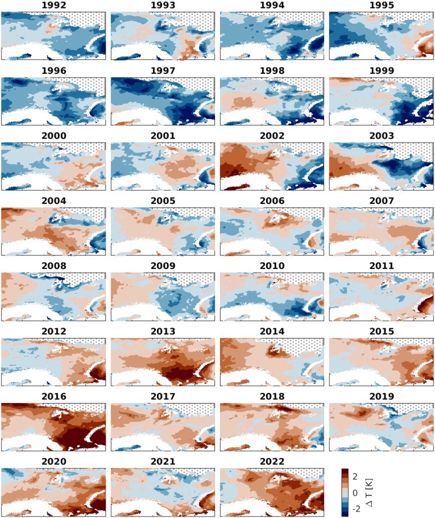
Since the 1990s, Russian and international teams have deployed AWS units on several islands, including Rudolf Island (the northernmost point of Eurasia) and Hall Island. A 2018–2022 Roshydromet program combined these stations with satellite‑derived sea‑ice concentration data to assess the response of the archipelago’s climate to Arctic warming. Findings indicate a modest upward trend in summer temperatures of about 0.3 °C per decade, accompanied by a reduction in the duration of continuous sea‑ice cover from an average of 340 days in the 1970s to 315 days in the 2020s.
What Has Changed
Key climatological changes over the past half‑century include:
| Parameter | 1970s Average | 2020s Average | Change |
|---|---|---|---|
| July mean temperature | 8 °C | 9 °C | +1 °C |
| January mean temperature | -13 °C | -12 °C | +1 °C |
| Annual precipitation | 320 mm | 335 mm | +15 mm |
| Mean wind speed | 46 km/h | 49 km/h | +3 km/h |
| Days with sea‑ice cover | 340 | 315 | -25 days |
While the temperature rise is modest compared with lower latitudes, it has pronounced effects on the archipelago’s glacial mass balance and on the distribution of sea‑ice‑dependent wildlife such as polar bears and ivory gulls.
Uncertainty and Open Questions
Data gaps remain because the extreme remoteness limits year‑round station maintenance. Key uncertainties include:
- Long‑term trends in snowfall versus rain events, which affect snowpack stability and melt timing.
- Interactions between wind‑driven sea‑ice export and local atmospheric circulation.
- Potential feedbacks from permafrost thaw on surface albedo and regional heat flux.
Future research priorities emphasize autonomous sensor networks, high‑resolution climate modeling, and integration of Indigenous knowledge from Arctic coastal communities on the Barents Sea rim.
Data Sources
Climatological statistics are drawn primarily from the Timeanddate.com long‑term averages for the Malye Karmakuly station (2012‑2021). Supplementary data come from Roshydromet’s Arctic monitoring program, the World Meteorological Organization, and peer‑reviewed literature on Arctic climate change.
FAQ
What is the typical temperature range in Franz Josef Land during summer?
Summer temperatures are brief and cool, with average highs of 9 °C in July and lows around 6 °C. The warmest recorded temperature is 11 °C.
How much precipitation does Franz Josef Land receive, and in what form?
The archipelago receives about 335 mm of precipitation annually, most of which falls as snow throughout the year; rainfall is rare and usually limited to the brief summer months.
Are the winds in Franz Josef Land stronger than in other Arctic regions?
Yes. Mean wind speeds average 49 km/h, with the windiest month (December) reaching 60 km/h, making the islands among the windier parts of the high Arctic.




Leave a Reply