
Short Answer
Location
Wilczek Land lies in the high Arctic Ocean at approximately 80°35′ N latitude and 60°30′ E longitude. It is part of the Franz Josef Land archipelago, which belongs to Arkhangelsk Oblast, Russia.
Map
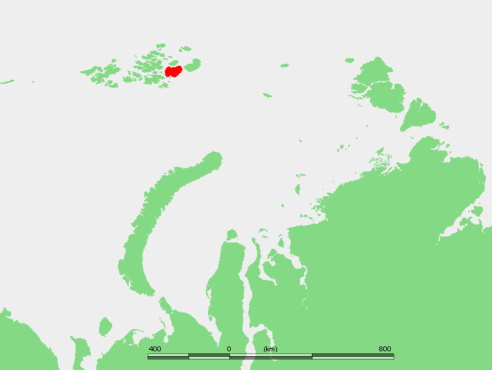 The island is situated east of Hall Island and west of the narrow Avstriyskyy Proliv (Austrian Strait) that separates it from Gallya Island. Detailed topographic maps show the island’s heavily glaciated terrain, the western ice‑free strips, and the surrounding minor islets such as Klagenfurt Island and the Gorbunov islets.
Geography
Covering an area of 2,203 km², Wilczek Land is the second‑largest island of Franz Josef Land after Zemlya Georga. The island is almost entirely covered by glaciers, with two narrow ice‑free zones along its western shoreline. Its highest elevation is 606 m (1,988 ft) at the summit of the Wüllerstorf Mountains. The westernmost point is Cape Ganza (Mys Ganza), while Cape Heller (Mys Geller) on the north‑eastern coast was a wintering site for the 1898–99 Wellman Expedition.
Glaciers
The island hosts a series of prominent ice domes and outlet glaciers:
| Ice Feature | Location | Notes |
|---|---|---|
| Kupol Arktirazvedki | North‑eastern part | Largest ice dome on the island |
| Stremitelny Glacier (Lednik Stremitel’nyy) | West of Arktirazvedki | “Rushing” glacier terminating on the north shore |
| Molochny Glacier (Lednik Molochnyy) | Further west | “Milky” glacier also terminating northward |
| Kupol Tindalya | Eastern central area | Named after glaciologist John Tyndall |
| Znamenity Glacier (Lednik Znamenityy) | South‑west of Tindalya | Flows to the southern coast east of Kupol Oblachnyy |
| Kupol Oblachnyy | Southern end | “Cloudy Dome” at the island’s southern extremity |
Geology
The bedrock of Wilczek Land consists primarily of Precambrian metamorphic complexes overlain by Pleistocene glacial deposits. The island’s rugged topography is the result of repeated glacial erosion, with the remaining nunataks and the Wüllerstorf Mountains exposing resistant gneiss and schist. Detailed lithological mapping remains limited due to the persistent ice cover.
Wildlife
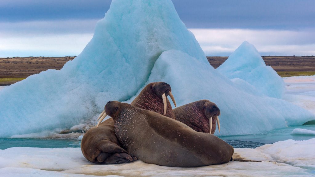
Despite its extreme latitude, the island supports typical high‑Arctic fauna. Polar bears (Ursus maritimus) use the sea‑ice margins for hunting, while ringed seals (Pusa hispida) haul out on the ice‑free western shores. Bird life is sparse but includes occasional visits by ivory gulls (Pagophila eburnea) and snow buntings (Plectrophenax nivalis) during the brief summer.
Exploration History
Wilczek Land was first sighted during the Austro‑Hungarian North Pole Expedition of 1872‑74, which named the island after Count Johann Nepomuk Wilczek, the expedition’s principal patron (though he never visited the archipelago). The island later featured in the American Wellman Expedition (1898‑99); two Norwegian crew members, Paul Bjørvig and Bernt Bentsen, wintered at Cape Heller, where Bentsen died and Bjørvig kept his companion’s body in a sleeping bag for 55 days before rescue.
Historic Sites
Key historic locations include:
- Cape Heller (Mys Geller): 1898‑99 Wellman winter camp.
- Wilczek Land’s western ice‑free strips: occasional temporary shelters for early explorers.
- Klagenfurt Island: a minor island named after the Austrian city of Klagenfurt, reflecting the expedition’s Central European ties.
Scientific Research
Modern Russian and international teams conduct glaciological monitoring, climate modeling, and biodiversity surveys on Wilczek Land. Remote sensing (SAR and optical satellites) tracks ice‑dome dynamics, while field campaigns in summer collect ice cores to reconstruct Holocene climate variability. The island’s isolation makes it a valuable natural laboratory for studying Arctic cryosphere responses to warming.
Name Origin
The island’s name honors Count Johann Nepomuk Wilczek (1845‑1922), an Austro‑Hungarian nobleman whose financial support enabled the 1872‑74 Austro‑Hungarian polar expedition that first charted the archipelago.
Related Islands
Several smaller islands lie in the immediate vicinity of Wilczek Land:
- Klagenfurt Island: ~9 km south of Wilczek Land’s southern bay, named after the Austrian capital.
- Ostrova Gorbunova: Two islets off the eastern coast (80°34′ N, 62°01′ E), named for Russian naturalist Gregory Petrovich Gorbunov.
- Ostrov Derevyannyy: 1.5 km off the southeastern cape; originally “Tree Island” after Lambert Tree.
- Ostrov Daues (Dawes Island): Named for U.S. Comptroller Charles G. Dawes, a Wellman donor.
- Ostrov Mak‑Nul’ta: Likely commemorates American politician John McNulta.
- Ostrov Tillo: Named for Ukrainian cartographer Oleksiy Tillo.
FAQ
Why is Wilczek Land almost completely covered by ice?
Its high latitude (over 80° N), low annual temperatures, and persistent Arctic sea‑ice conditions promote year‑round glaciation, leaving only narrow coastal strips ice‑free.
What historic events are associated with Cape Heller?
Cape Heller was the wintering site for Norwegian members Paul Bjørvig and Bernt Bentsen of the 1898‑99 Wellman Expedition; Bentsen died there, and Bjørvig preserved his body for 55 days until rescue.
Are there any research stations on Wilczek Land?
No permanent stations exist, but seasonal field camps are established by Russian and international teams for glaciological and biological studies during the brief Arctic summer.


Leave a Reply