
Short Answer
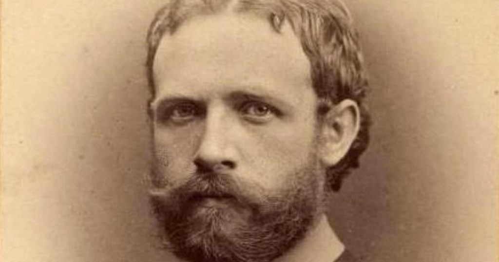
Julius von Payer (2 September 1841 – 29 August 1915) was an officer of the Austro‑Hungarian Army, an accomplished alpine explorer, and a cartographer whose work reshaped the understanding of the high Arctic. As commander on shore of the Austro‑Hungarian North Pole Expedition (1872–1874), he oversaw the discovery, surveying, and first reliable mapping of the archipelago later designated Franz Josef Land.
The expedition sailed from Trieste aboard the iron‑clad corvette SMS Tegetthoff, under the sea command of Captain Karl Weyprecht. After a winter trapped in the pack ice of the Barents Sea, the party broke free in June 1873 and sighted a previously unknown group of islands at roughly 81° N. Over the following year Payer’s sled teams charted more than 190 islands, producing a topographic map at a scale of 1:56 000 that remained the reference for decades.
Who Was Julius von Payer / The Expedition
Born in Schönau, Bohemia, Payer entered the Theresian Military Academy in 1857 and served in the Austrian infantry during the Italian wars of 1859 and 1866. After a distinguished Alpine career that yielded more than 60 first ascents, he was appointed a general‑staff officer at the k.k. Military Geographic Institute in Vienna in 1868, where he met August Petermann and Karl Weyprecht. The Austro‑Hungarian North Pole Expedition (1872–1874) was organized by the Austro‑Hungarian Ministry of War to achieve both scientific and national prestige goals; Payer was selected as the expedition’s chief land commander and cartographer, while Weyprecht commanded the ship.
Objectives
- Scientific: systematic magnetic, meteorological, and hydrographic observations; collection of geological and biological specimens.
- Geographic: search for a navigable north‑eastward sea route and, if possible, the hypothesized undiscovered land north of Novaya Zemlya.
- National: demonstrate Austro‑Hungarian capability in polar exploration and secure a place on the map of the Arctic.
Route
The expedition departed Trieste on 6 June 1872, transited the Strait of Otranto, crossed the Mediterranean, and entered the Atlantic via the Strait of Gibraltar. After rounding the British Isles, the squadron entered the Barents Sea, where the ice forced a winter encampment near 78° N in early 1873. In June 1873 the ice cleared, allowing the party to advance northward; on 30 June Payer’s sled party recorded the first sighting of the newly emerging land (later Franz Josef Land). Over the summer of 1873 they explored the northern islands, and in the 1874 season they pushed further east, mapping the eastern and southern coasts before returning to Vienna in August 1874.
Timeline
| Date | Event |
|---|---|
| 6 June 1872 | Departure from Trieste aboard SMS Tegetthoff |
| Winter 1872‑73 | Ice‑bound winter in the Barents Sea; scientific observations recorded |
| 30 June 1873 | First sighting of Franz Josef Land by Payer’s sled party |
| Summer 1873 | Initial coastal surveys of the northern islands |
| Summer 1874 | Extended sledge journeys; completion of topographic map of >190 islands |
| 13 August 1874 | Return to Vienna; presentation of findings to the Imperial Academy |
| 1875 | Award of the Royal Geographical Society’s Patron’s Medal |
| 24 October 1876 | Elevation to the Austrian nobility as Ritter von Payer |
The Franz Josef Land Connection
Payer’s sled surveys established the archipelago’s overall outline, identified the main island groups (e.g., Zichy, Graham Bell, and Hall), and recorded the positions of prominent capes such as Cape Heller and Cape Flora. His cartographic output, published in 1875–76, supplied the first accurate coordinates for the islands and confirmed their existence to a skeptical scientific community. The naming of the archipelago after Emperor Franz Joseph was formalized in the expedition’s report, and the name has persisted in both German and Russian usage (Zemlya Frantsa‑Iosifa).
Challenges and Hardships
- Ice conditions: The fleet spent months trapped in dense pack ice, requiring constant hull maintenance and the use of steam‑driven pumps.
- Health: Crew members suffered from scurvy and frostbite; Payer himself recorded several cases in his field diary.
- Logistics: Supplies for sledge parties were limited to dried meat, hardtack, and a small stock of lime; resupply was impossible once the ice closed.
- Political pressure: After the expedition’s return, critics in Vienna questioned the reality of Franz Josef Land, leading to a temporary denial of Payer’s promotion.
Discoveries and Achievements
- Geographic: Confirmation and mapping of an archipelago comprising roughly 190 islands, extending to about 1 600 km² of ice‑covered land.
- Cartographic: Production of a 1:56 000 topographic map that remained the authoritative reference until the Soviet surveys of the 1930s.
- Scientific: Collection of magnetic declination data, meteorological records, and a modest geological sample set that documented Jurassic–Cretaceous marine sediments.
- Recognition: Award of the Royal Geographical Society’s Patron’s Medal (1875) and ennoblement as Ritter von Payer (1876).
Outcome and Fate
Despite the scientific success, Payer faced political opposition; his anticipated promotion to captain was withheld, prompting his resignation from the army in 1874. He subsequently pursued a career in painting, establishing a school in Vienna, but remained a respected figure in polar circles. The discovery of Franz Josef Land spurred further exploration, notably the British Jackson‑Harmsworth Expedition (1894–95) and later Soviet annexation in 1926.
Historical Significance
The Austro‑Hungarian North Pole Expedition marked the first systematic European penetration of the high Arctic north of Novaya Zemlya. Payer’s cartographic work transformed a phantom region into a concrete geographic entity, influencing subsequent scientific, commercial, and geopolitical activities in the Barents Sea. The expedition also demonstrated the feasibility of long‑duration ice‑bound voyages, informing later endeavors such as Nansen’s Fram expedition.
Primary Sources
The principal documentary record consists of Payer’s field diaries, the official multi‑volume report Die österreichisch‑ungarische Nordpol‑Expedition 1872–1874 (published 1876), and contemporary articles in the Royal Geographical Society’s Geographical Journal (1875). Sketches and maps produced by Payer are preserved in the Austrian State Archives, providing direct visual evidence of the early surveys.
Related Expeditions
Prior to the 1872–74 venture, Payer participated in the German North Polar Expedition (1869–70) aboard the Germania, gaining valuable polar experience. The discovery of Franz Josef Land set the stage for later missions such as the 1894–95 Jackson‑Harmsworth Expedition, Fridtjof Nansen’s 1895 wintering at Cape Flora, and the 1900 Duke of the Abruzzi’s record sledge march across Rudolf Island.
FAQ
When and how was Franz Josef Land first discovered?
The archipelago was first sighted by a sled party led by Julius von Payer on 30 June 1873 during the Austro‑Hungarian North Pole Expedition, after the ship Tegetthoff broke free from the Barents Sea ice.
What was Julius von Payer’s role in the expedition?
Payer served as the chief land commander and cartographer, responsible for planning and executing the sledge surveys that produced the first accurate maps of the islands.
Why was the discovery initially disputed?
Some Viennese officials and scientists doubted the existence of the islands because the expedition’s reports relied on sketches and diaries; the lack of an immediate independent verification led to criticism and delayed Payer’s promotion.
What honors did Payer receive for his Arctic work?
He was awarded the Royal Geographical Society’s Patron’s Medal in 1875 and was ennobled as Ritter von Payer on 24 October 1876.

Leave a Reply