
Short Answer
Location
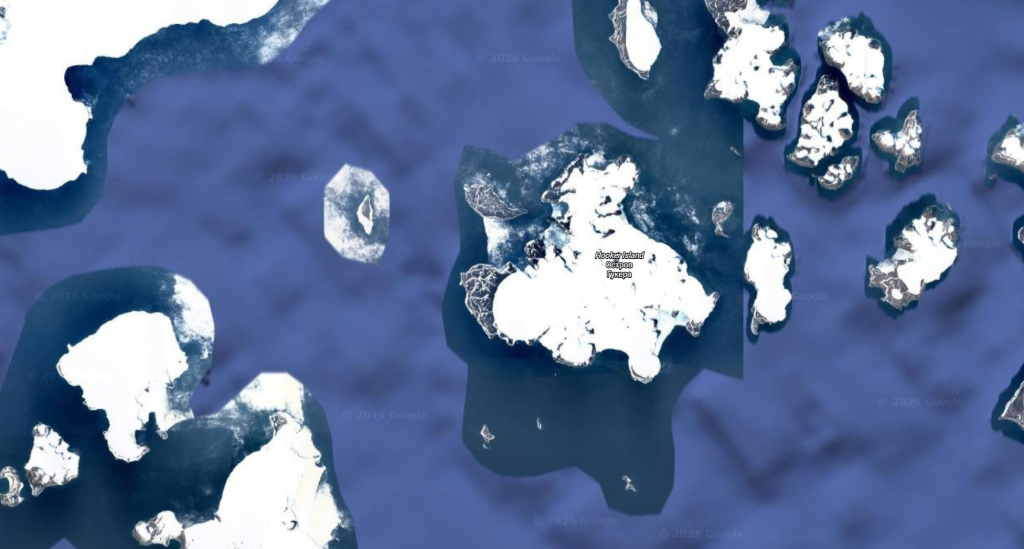
Hooker Island (Russian: остров Гукера) is situated in the central sector of the Franz Josef Archipelago at 80°14′N 53°02′E, approximately 800 km north of the Russian mainland. The island belongs administratively to Arkhangelsk Oblast, Russia, and is uninhabited.
Map
The island is bounded by De Bruyne Sound to the southwest, separating it from Northbrook Island, and by Young Sound to the north, which separates it from the Koetlitz, Nansen and Pritchet group. Coordinates for key features are:
- Hooker Island centre: 80°14′N 53°02′E
- Tikhaya Bay: 80°20′N 52°47′E
- Rubini Rock (Skala Rubini): 80°18′N 52°50′E
Geography
The island covers 459.8 km² (177.5 sq mi) with a roughly rectangular shape 32.8 km long (east‑west) and 29.9 km wide (north‑south). Its coastline is heavily indented by bays and capes; the western ice‑free inlet of Tikhaya Bay provides the only natural harbour. The highest point is the summit of the western ice dome, Kupol Dzhensona, rising to 576 m (1,890 ft) above sea level.
Glaciers
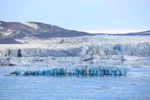
Hooker Island is largely glaciated. The principal ice masses are:
| Glacier / Ice Dome | Location | Maximum Elevation (m) |
|---|---|---|
| Kupol Dzhensona | Western dome | 576 |
| Kupol Yuriya | North‑central dome | — |
| Obruchev Glacier | Southern shoreline | — |
These ice bodies feed the surrounding seas and influence local microclimates, especially in Tikhaya Bay where seasonal melt creates a shallow, brackish pool.
Geology
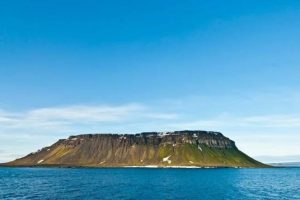
The bedrock of Hooker Island consists predominantly of Paleozoic sedimentary sequences overlain by extensive Pleistocene glacial deposits. Columnar basalt formations, most famously Rubini Rock, are remnants of late Cretaceous volcanic activity that have been sculpted by freeze‑thaw weathering. The island’s geology records both marine fossil assemblages (including plesiosaur vertebrae) and terrestrial megafauna remains such as caribou antlers, indicating past climatic warmth.
Wildlife
Despite its severe climate, the island supports a modest but biologically important fauna. The seabird colony at Rubini Rock hosts thousands of breeding pairs of guillemots, kittiwakes and Atlantic puffins, attracted by the sheer basalt cliffs. Marine mammals—walrus, ringed seal and occasional polar bear—use the ice‑free shores of Tikhaya Bay for haul‑out. Terrestrial vegetation is limited to mosses, lichens and a few flowering plants in the ice‑free zones.
Exploration History
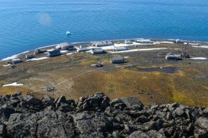
Hooker Island was first sighted during the 1880 British expedition led by Benjamin Leigh Smith, who named it after the naturalist Sir Joseph Dalton Hooker. The island later served as a logistical hub: Tikhaya Bay housed a Soviet meteorological station from 1929 to 1963 and a major base for polar expeditions. In July 1931 the German airship Graf Zeppelin over‑flew the island during a pioneering aerial survey. During World II, German staff were stranded on Hooker Island from 1941 until the war’s end in 1945.
Historic Sites
Remnants of the Soviet era remain at Tikhaya Bay, including two modern structures and a small graveyard where expedition members are interred. The abandoned base provides a rare glimpse into mid‑20th‑century Arctic fieldwork. Rubini Rock, while a natural formation, is also regarded as a cultural landmark due to its long‑standing use by indigenous hunters and later by scientific parties as a bird‑watching platform.
Scientific Research
Since the cessation of the Soviet station, Hooker Island has been visited sporadically by Russian and international research teams. Studies have focused on:
- Glaciological monitoring of Kupol Dzhensona and Kupol Yuriya to assess climate‑induced retreat.
- Paleontological surveys of marine reptile fossils, informing Arctic Mesozoic biogeography.
- Avian ecology at Rubini Rock, documenting breeding success of Arctic seabirds under changing sea‑ice conditions.
Data collected contribute to broader Arctic climate models and biodiversity assessments.
Name Origin
The island bears the name of Sir Joseph Dalton Hooker (1817‑1911), a pre‑eminent British botanist who participated in James Clark Ross’s Antarctic expedition aboard the Erebus and Terror in 1839. The naming reflects the tradition of honoring scientific contributors during the age of discovery.
Related Islands
Several smaller islands lie in the immediate vicinity of Hooker Island and share similar geological and historical contexts:
- Leigh‑Smith Island – 14 km long, glacier‑covered, named after the discoverer of Hooker Island.
- Royal Society Island – 6 km long, named for the Royal Geographical Society.
- Scott‑Keltie Island – off Tikhaya Bay, named for geographer Sir John Scott Keltie.
- Eaton Island – 3 km long, commemorates Rev. Alfred Eaton.
- Newton Island – 11 km south, named after ornithologist Alfred Newton.
- May Island – double island 5 km southwest, named for naval artist Walter Waller May.
- Etheridge Islands – two islets 6 km west of May Island, honoring paleontologist Robert Etheridge.
These islands together illustrate the pattern of 19th‑century British naming conventions across Franz Josef Land.
FAQ
Why is Hooker Island uninhabited today?
The island’s extreme Arctic climate, permanent ice cover, and lack of economic resources make permanent settlement impractical; the former Soviet station was closed in 1963.
What wildlife can be observed at Rubini Rock?
Rubini Rock hosts large colonies of Arctic seabirds such as guillemots, kittiwakes and Atlantic puffins, as well as occasional visits by polar bears hunting on the surrounding sea ice.
How can researchers access Tikhaya Bay?
Access is generally by ice‑breaker or research vessel during the brief summer melt window, followed by over‑land travel on snowmobiles or skis to the historic base.



Leave a Reply