
Short Answer
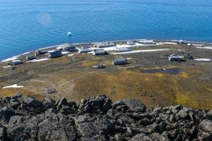
Hayes Island (Russian: Остров Хейса, romanized: Ostrov Kheysa), also rendered Heiss Island in early German maps, lies in the heart of the Franz Josef Land archipelago in the Russian High Arctic. Covering roughly 132 km², the island rises to a modest 242 m at its highest point and is distinguished by an almost unglacierized terrain punctuated by a small ice cap along its northern shore. Today the island is uninhabited but hosts the Krenkel hydrometeorological station and the ruins of a Soviet‑era rocket launch complex, making it a valuable node for polar research.
Discovered during the Austro‑Hungarian North‑Pole Expedition of 1873–74, Hayes Island was first charted on Julius Payer’s 1874‑75 map and later renamed in honor of the American Arctic veteran Isaac Hayes (1800–1863). The island’s strategic location between Hall Island to the south and Wilczek Land to the north, together with its relatively ice‑free coasts, has drawn successive waves of explorers, Soviet scientists, and modern climatologists.
Location
Hayes Island is situated at 80°27′ N, 58°03′ E (80.450° N, 58.050° E) in the central sector of Franz Josef Land, Russian Arctic National Park, Arkhangelsk Oblast. The island lies north of Hall Island, east of Champ Island, and west of the smaller Komsomol Islands. The strait separating Hayes from the Zichy Land subgroup to the north is Proliv Yermak, only 7 km wide.
Map
On Payer’s original 1874 chart the island appears as a roughly triangular landmass oriented east‑west, extending about 18 km east‑west and 12 km north‑south. Early British and American charts labeled it “Heiss” after a transliteration error, while Soviet maps of the 1930s adopted the Russian form “Kheysa”. Modern Russian nautical charts depict the island with its principal capes—Cape Ostantsovy on the southwestern shore and a small unnamed cape on the northeastern point—along with the adjacent Markham Sound (5 km narrow) to the south.

Geography
The coastline is irregular, with a broad, low‑lying bay on the western side and a series of shallow inlets on the eastern flank. The island’s interior is dominated by tundra‑type vegetation and exposed bedrock, interrupted only by the modest ice cap that clings to the northern central plateau. The highest elevation, 242 m (794 ft), is an unnamed hill near the island’s centre, offering a limited view over the surrounding sea ice.
Glaciers and Ice Cover
Unlike many of its neighbours, Hayes Island is almost free of permanent glaciation. A small ice dome, less than 5 km² in area, occupies the north‑central sector and retreats seasonally during the brief Arctic summer. The remaining land surface is permafrost‑underlain tundra, with seasonal snow cover persisting for most of the year. The paucity of ice makes Hayes a useful reference point for comparative glaciological studies across the archipelago.
Geology
Geologically, Hayes Island consists primarily of Jurassic–Cretaceous marine sedimentary rocks, including sandstones and shales that have been mildly folded during the late Cretaceous tectonic uplift of the archipelago. Scattered basaltic dykes intrude the sedimentary sequence, reflecting the widespread dolerite magmatism that characterises much of Franz Josef Land. Fossiliferous layers, though not extensively studied, have yielded marine invertebrate remains indicating a once‑submerged paleo‑environment.
Wildlife
The island’s ice‑free shores provide haul‑out sites for walruses (Odobenus rosmarus) and seasonal rookeries for seabirds such as the ivory gull (Pagophila eburnea) and Brünnich’s guillemot (Uria lomvia). Polar bears (Ursus maritimus) are occasional visitors, using the island as a resting point while traversing the surrounding pack ice. The surrounding waters support bowhead (Balaena mysticetus), beluga (Delphinapterus leucas), and occasional narwhal (Monodon monoceros) sightings.
Exploration History
The Austro‑Hungarian North‑Pole Expedition, led by Julius Payer and Karl Weyprecht, first sighted the island in 1873 during their search for the Northeast Passage. Payer’s 1874‑75 map recorded the landform, and the island was subsequently named after Isaac Hayes, who had led a historic polar expedition in 1850. Subsequent British explorer Benjamin Leigh Smith visited the central archipelago in 1880, confirming the island’s position. The Jackson–Harmsworth Expedition (1894–95) used Hayes Island as a navigation waypoint while wintering at nearby Cape Flora.
During the Soviet period, the island gained strategic importance. In 1955 a short‑lived rocket launch site, codenamed “Kheysa”, was constructed on the western coast for experimental sub‑orbital flights. The facility was abandoned by the early 1960s, leaving concrete pads and rusted launch structures that remain visible today.
Historic Sites
| Feature | Type | Year Established | Status |
|---|---|---|---|
| Krenkel Hydrometeorological Station | Research station | 1962 | Operating (seasonal) |
| Soviet Rocket Launch Complex | Military/Scientific | 1955 | Ruins, not in use |
| Explorers’ Cairn | Memorial | 1880 (Leigh Smith) | Intact, listed as cultural heritage |
Scientific Research
The Krenkel Hydrometeorological Station, named after the famed Soviet radio‑operator Ernst Krenkel, has operated intermittently since 1962. Located at 80°37′ N, 58°03′ E on the island’s eastern shore, the station records air temperature, atmospheric pressure, humidity, wind speed, and precipitation. Data from Krenkel contribute to the Russian Arctic National Park’s climate monitoring network and to global datasets such as the World Meteorological Organization’s Arctic climate normals.
Because Hayes Island is largely ice‑free, it serves as a baseline site for studying permafrost dynamics, coastal erosion, and the response of Arctic tundra ecosystems to warming. Recent satellite‑based investigations (2020‑2024) have documented a modest northward shift of the island’s ice cap margin, consistent with a mean July temperature increase of approximately 0.5 °C relative to the 1961‑1990 baseline.
Name Origin
The island’s English name commemorates Isaac Hayes (1800–1863), an American naval officer and Arctic explorer who led a 1850 expedition that reached the vicinity of the North Pole. German cartographers later rendered the name as “Heiss” after transliterating the Russian transcription “Хейса” (Kheysa), a misspelling that persisted on some early 20th‑century maps. The Russian designation Остров Хейса (Ostrov Kheysa) has been official since the Soviet annexation of Franz Josef Land in 1926.
Neighboring Islands and Straits
Hayes Island is flanked by several notable features. To the south, the narrow Markham Sound separates it from Hall Island, narrowing to just 5 km at its tightest point. Eastward lie the Komsomol Islands, a tri‑island group extending about 7 km. To the north, Proliv Yermak isolates Hayes from the Zichy Land subgroup, while the Avstriyskiy Proliv (Avrory Strait) runs along its eastern side, opening toward the larger Wilczek Land. These waterways are seasonally obstructed by pack ice, influencing both historic navigation and modern scientific access.
FAQ
Why is Hayes Island also called Heiss Island?
German cartographers transliterated the Russian name Остров Хейса (Ostrov Kheysa) as “Heiss”, which inadvertently became a variant spelling on early 20th‑century maps.
What scientific observations are made at the Krenkel station?
The station records air temperature, pressure, humidity, wind speed, precipitation, and provides data for permafrost and climate change studies in the High Arctic.
Is any glacial ice present on Hayes Island?
Only a small ice cap occupies the north‑central part of the island; the rest of the land is largely ice‑free and tundra‑covered.


Leave a Reply